|
Have you ever wondered how the coast of Puerto Rico has changed over 90 years? This is another very cool project with which we have collaborated with the University of Puerto Rico at Mayagüez. 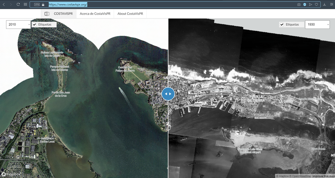 https://www.costavispr.org/
0 Comments
We have been collaborating with Dr. Tania Lopez Marrero who with her students at the UPR Mayaguez has published a set of aerial photographs for the coast of Puerto Rico for 1930, 1936 , and 1950s. This is a very good resource for those with interest in looking at changes in the coastal environment of the island. The imagery is in 3 different formats (GeoTiff, KML and JPG). This is the Web site (http://www.prgeoref.org). I would recommend to first download the PDF of report. Click on the image to go to the project web site. 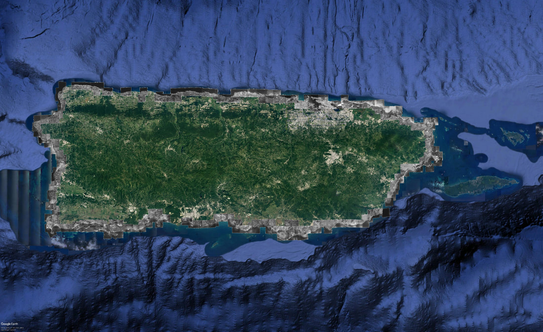 El año pasado colaboramos con el Centro Interdisciplianrio de Estudios del Litoral de la Universidad de Puerto Rico en Mayaguez (CIEL) en la elaboración de este documento. Este libro, es el resultado de un proyecto que llevó a cabo la Profesora Tania Lopez Marrero en una de sus clases. 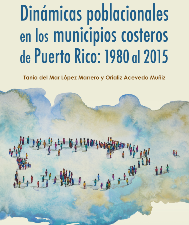 Haga clic sobre la imagen para obtener el documento en formato PDF.
Aqui un ejemplo básico de un potencial análisis de GIS para establecer prioridades de preparacion, y recuperacion, para Puerto Rico 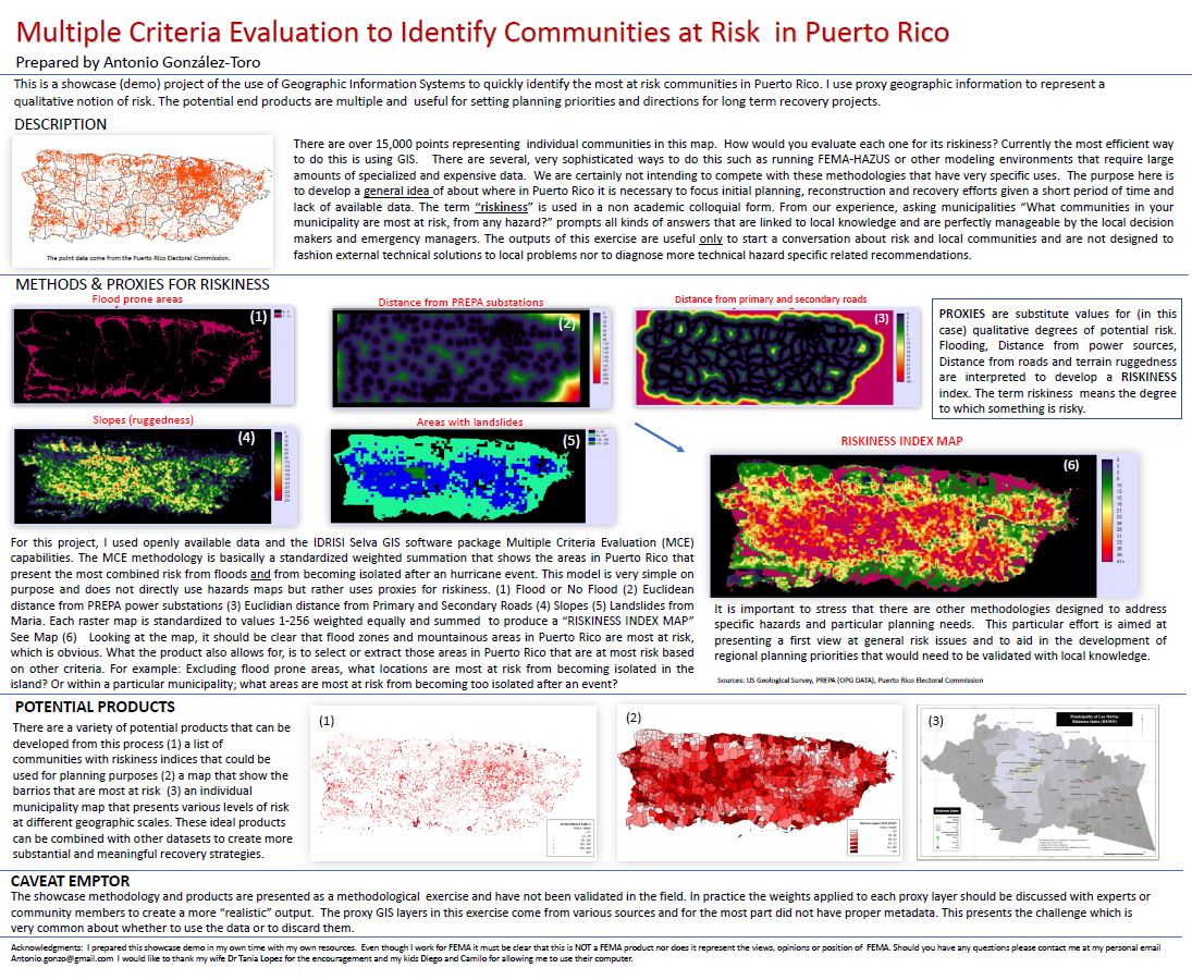
Hurricane Maria has been catastrophic in many ways for Puerto Rico. It has shown us how frail and poorly planed our infrastructure is. Recovery efforts are still underway and will be for years. NOAA has published a set of aerial photos taken immediatey after hurricane Maria, that are being used actively for various purposes such as recovery tasks, inventory development, and damage assesment. Click on the image to visit the NOAA site. 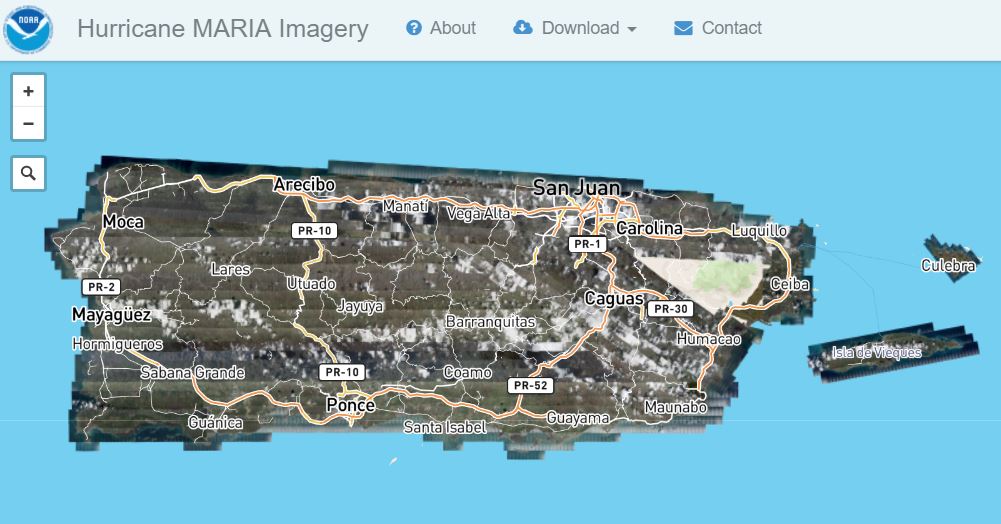 For those who are GIS proficient (and have a fast connection) some the imagery can be downloaded.
|
Antonio González-ToroI write about GIS and Geographical topics. Archives
October 2020
Categories |
||
 RSS Feed