Our Work
Some of our Past clients
|
|
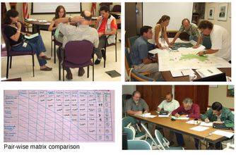
For the US Forest Service we developed a Multi-criteria Evaluation (MCE) for Land Use Planning for El Yunque National Forest. The purpose of the project was to establish a set of land use management priorities based on expert knowledge of the area. The outputs of this project are being used by local, state and the federal governments.
|

|
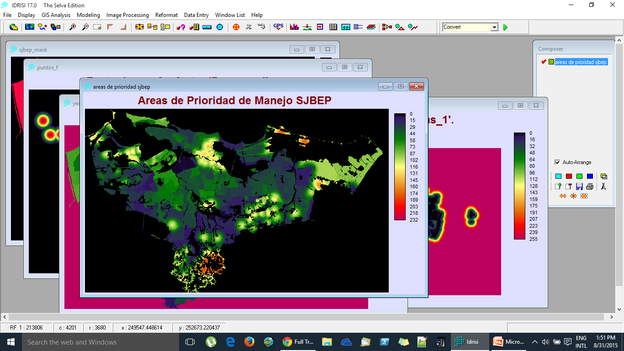
For The San Juan Bay Estuary Program (SJBEP)also used the MCE technique coupled with focus groups for the purposes of identifying the areas within the SJBEP that produce the most raw sewage discharges. The screen capture below shows a preliminary output of the process where areas in red represent the locations within the SJBEP region where more raw sewage discharges could be expected given a set of weighted criteria as chosen by experts.
Iniciativa Tecnológica Centro Oriental (INTECO), a local business incubator and accelerator hired us to develop a building and land inventory for their area of interest. The idea behind the inventory was to identify, qualify and publish. The interactive map shown below presents over 600 points with field gathered data related to this project.
Cafiesencia , a local NGO, initially hired us to help them develop the cartography and basic GIS analysis for the development of forestry plans for several local farms and later hired us to provide GIS workshops to local farmers in Puerto Rico and in the US Virgin Islands.
|
|
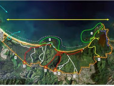
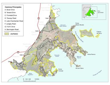
We have worked with the Puerto Rico Land Conservation Trust (now called, Para la Naturaleza) in several projects. Among them, the Roosvelt Roads Land Use Plan, the Puerto Rico Northeastern Corridor Land Use Plan, and the Land Managment Plans for many or their properties.
|
|
GIS Software Training
We offer GIS training using alternative (inexpensive) or Open Source software. It is our belief that the value that these software packages offer is huge and are great alternatives for small and medium enterprises that wish to include this capability as part of their work
There are literally hundreds of GIS or GIS related software packages. The decision to choose one should be based on many criteria and not solely on its price. We preffer.
QGISQGIS is currently the most exiting open source GIS software available. It is particularly well suited for small municipalities and consulting shops that need GIS capabilities without spending a lot of money. Its FREE.
|
IdrisiIdrisi (Now TerrSet) has the most extensive set of analytical GIS tools in the industry. It is one of the oldest academically developed GIS software packages available and has a large installed base. We offer limited training with Idrisi.
|
We also work with:
|