|
Cartography is about information, and information is power. One of the first maps made by the American occupation army of Puerto Rico was this one by Major William Glassford under the command of General A.W. Greely in 1900. What I find interesting about this map is that it shows the location of all the possible communication routes available within Puerto Rico at the time and their relative location to military posts. This map shows how power (military) needs means of communication both as means of actual control and for its own internal workings (organization, intelligence, and planning for example) without which control would not be feasible. 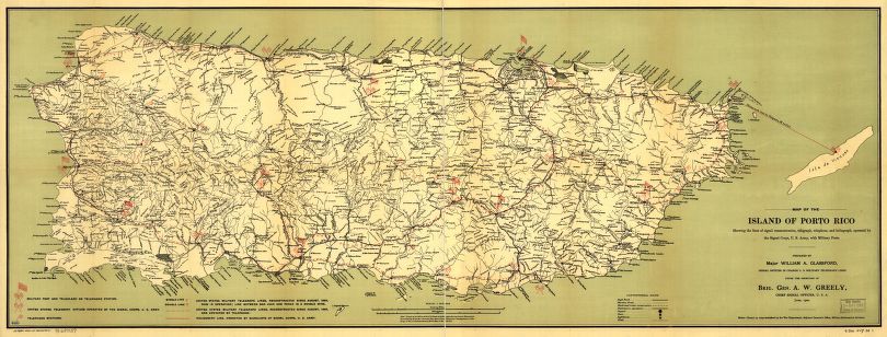 Map of the island of Porto Rico showing the lines of signal communication, telegraph, telephone, and heliograph, operated by the Signals Corps, U.S. Army, with military posts. Source: Library of Congress (retieved June 2017) - http://hdl.loc.gov/loc.gmd/g4971p.ct000304 The Glassford map was traced over an older map (a blue print) supplied by Birgadier General Roy Stone at a scale of 1:150,000. If you would like to view this map over Google Earth visit our Free Stuff page to download it in KMZ format. Here is a very rough interpretation of the communication lines and points in the Glassford map. But the map above, has much more information that would be useful for military purposes like roads, highways and rivers. 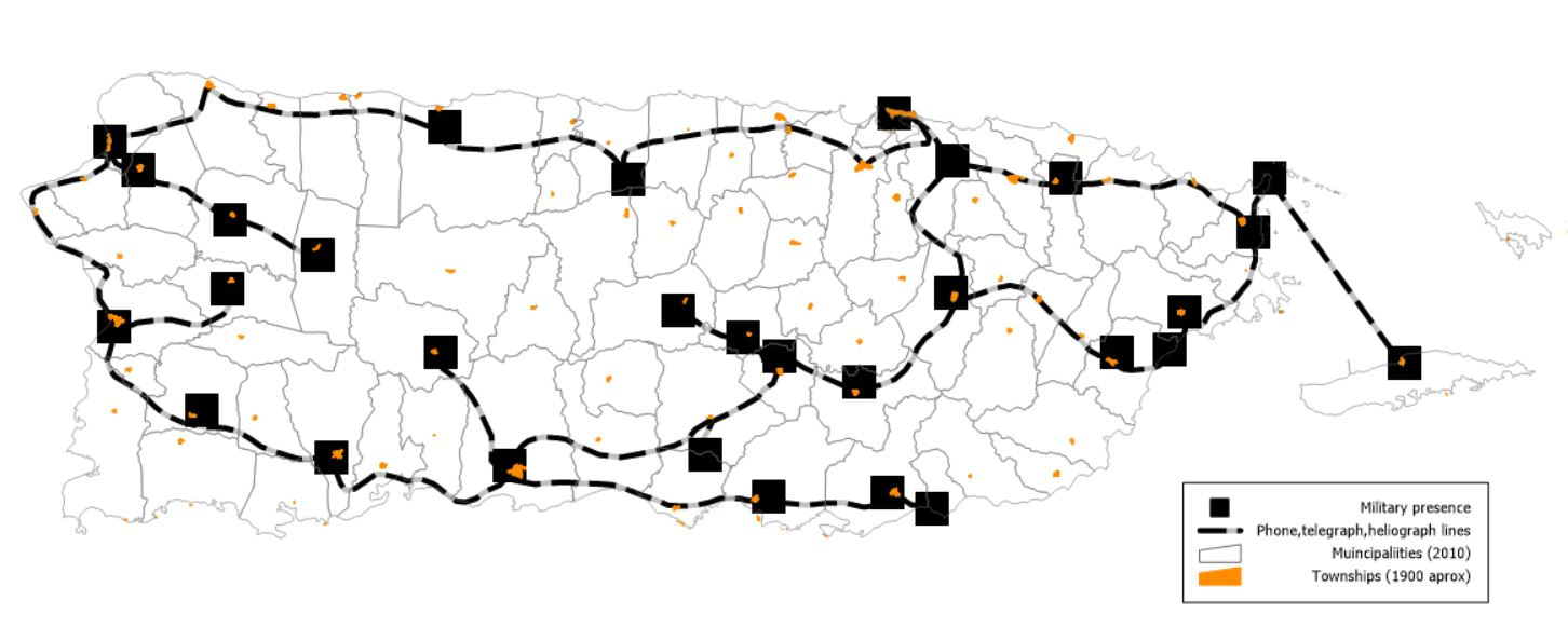
0 Comments
Your comment will be posted after it is approved.
Leave a Reply. |
Antonio González-ToroI write about GIS and Geographical topics. Archives
October 2020
Categories |
 RSS Feed