|
Hi all. The Porto Rico 1930 Georeferenciado project has motivated me to add more data to the free stuff page that I think may be usefull for urban planners and history enthusiasts.. 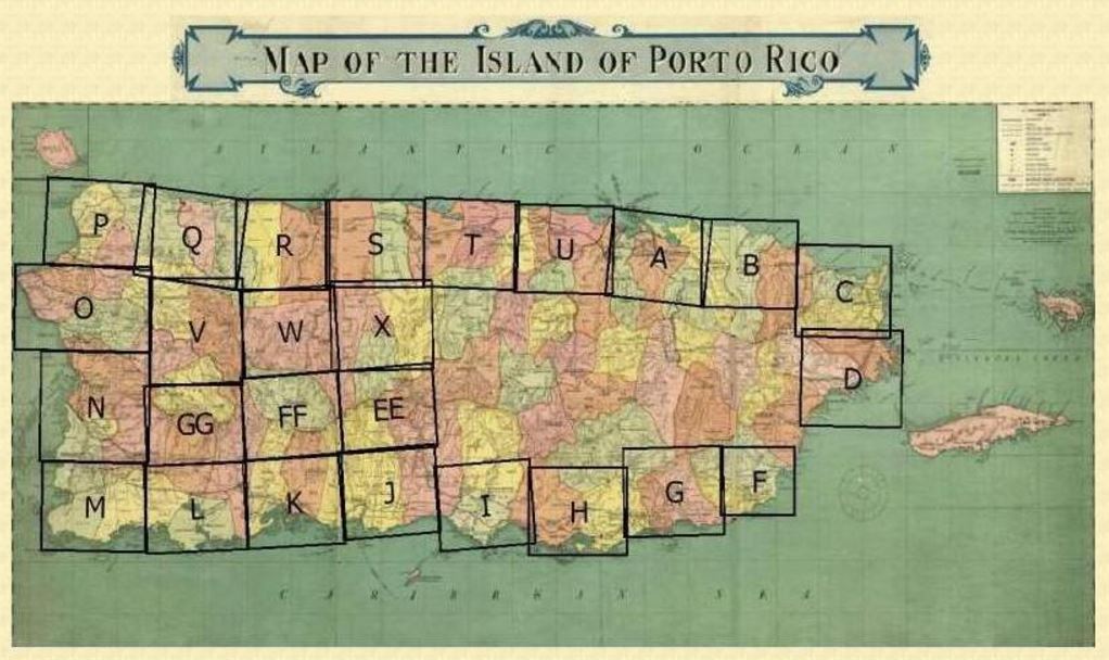 This image from (http://pr1930.revistatp.com) shows the coverage of the aerial photos available from the 1930-31 flights. Note that not all the island townships images are available. In the future, the images from a latter (1936) flight may be made available here.
Keep in mind that... The data are in the public domain, share them. The data are in KMZ format so are viewable using Google Earth as well as other GIS software programs. The data are published here as a gift to the community, we are not responsible for irresponsible use. The data will be available on our free stuff page for a limited time. Go to the free stuff page for the downloads. Hi all!
Firstly, thanks so much for visiting my page. In 2 days it has received over 2000 hits! One of the first suggestions we received for the "Porto Rico 1930 Georreferenciado" project was to publish the mosaics for use with Google Earth. Well I've got good news! All of the Porto Rico 1930 Georreferenciado mosaics have been published for Google Earth users here. http://www.geoinformaticapr.com/free-stuff.html Enjoy! One gets too exited about a project and tends to make all kinds of mistakes.. Well the links to the Porto Rico 1930 Georeferenciado project website were posted incorrectly in the original post. We were still making changes to the website. Here is are corrected links to the website.
www.prgeoref.org or http://prgeoref.weebly.com All comments are welcome. We have noted that the before and after page seems to load slowly sometimes. We will probably split that page into several in the future. 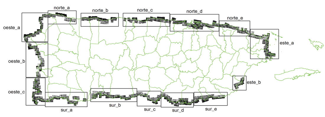 Have you ever wondered how the Puerto Rico coast looked like 90 years ago? The UPR at Mayagüez Center for Interdisciplinary Littoral Studies (CIEL) has just finished a project in which they took over 400 individual aerial photos and georeferenced them to create a series of mosaics of the coast. These are available to the public both in GIS (ECW format) and non GIS (JPG) formats. Most of the work was performed by UPRM students with Tania Lopez Marrero's guidance.
Please visit the new collaboration web site. www.prgeoref.org If you want to see some examples of how the Puerto Rico coast has changed, Visit this page. http://prgeoref.weebly.com/antes-y-ahora.html Great job CIEL! |
Antonio González-ToroI write about GIS and Geographical topics. Archives
October 2020
Categories |
 RSS Feed