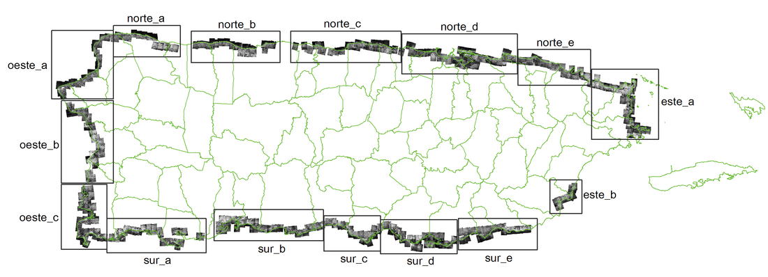
 Have you ever wondered how the Puerto Rico coast looked like 90 years ago? The UPR at Mayagüez Center for Interdisciplinary Littoral Studies (CIEL) has just finished a project in which they took over 400 individual aerial photos and georeferenced them to create a series of mosaics of the coast. These are available to the public both in GIS (ECW format) and non GIS (JPG) formats. Most of the work was performed by UPRM students with Tania Lopez Marrero's guidance.
Please visit the new collaboration web site. www.prgeoref.org If you want to see some examples of how the Puerto Rico coast has changed, Visit this page. http://prgeoref.weebly.com/antes-y-ahora.html Great job CIEL!
3 Comments
JP Zegarra
7/21/2017 09:24:58 am
Saludos... Los enlaces no me funcionan... Será muy útil éste recurso...
Mariano
7/22/2017 02:17:16 pm
Excelente!!! Your comment will be posted after it is approved.
Leave a Reply. |
Antonio González-ToroI write about GIS and Geographical topics. Archives
October 2020
Categories |
 RSS Feed