|
Playing around with apps for the website, I decided to add these before and after images. The image on the left is a scanned version of the Barañano Plan, on the right are the 2010 aerial images for the same area. The overlay is not perfect but it is always interesting to see the similarities and differences between a plan and reality. To interpret the map I also included the legend below. Enjoy! 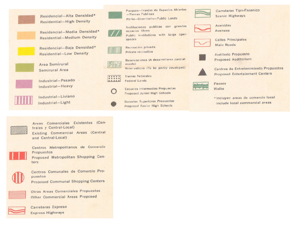
0 Comments
Your comment will be posted after it is approved.
Leave a Reply. |
Antonio González-ToroI write about GIS and Geographical topics. Archives
October 2020
Categories |
 RSS Feed