|
On the previous post, I mentioned that almost all of Puerto Rico's 1930 townships or old downtowns (cascos urbanos) are available for download (here) for viewing using Google Earth (as well as with other software). From the 1930s Puerto Rico has changed enormously in many respects and urban area growth is definitely one of the most dramatic changes that the island has suffered . This is a brief tutorial on how to load the KMZ files to Google Earth. 1. Install Google Earth Pro. (it is FREE!) 2. Run Google Earth  3. Download all the KMZ files from here. There are other free datasets available on this page as well. You are welcome to these as well. The download is relatively large (130MB approx.) It contains one ZIP file with 76 individual KMZ files, one per municipality. Culebra and Morovis are missing. 4. You have to save all these files to an uncompresed folder for them to work effectively. 5. On Goggle Earth, under file-open, choose KML/KMZ files (there are many other options here). Navigate to the folder were all the unzipped KMZ files for the municipalities are, and select the ones you want to see. I recommend that you select one or two at a time since Google Earth has a tendency to crash. 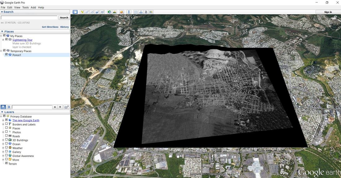 6. If you did everything right you should see the image (in this example I used the City of Ponce) display over the Google Earth display area. Now you can play with other Google Earth features such as available databases (photos for example). Enjoy!
0 Comments
Your comment will be posted after it is approved.
Leave a Reply. |
Antonio González-ToroI write about GIS and Geographical topics. Archives
October 2020
Categories |
 RSS Feed