|
Hurricane Maria has been catastrophic in many ways for Puerto Rico. It has shown us how frail and poorly planed our infrastructure is. Recovery efforts are still underway and will be for years. NOAA has published a set of aerial photos taken immediatey after hurricane Maria, that are being used actively for various purposes such as recovery tasks, inventory development, and damage assesment. Click on the image to visit the NOAA site. 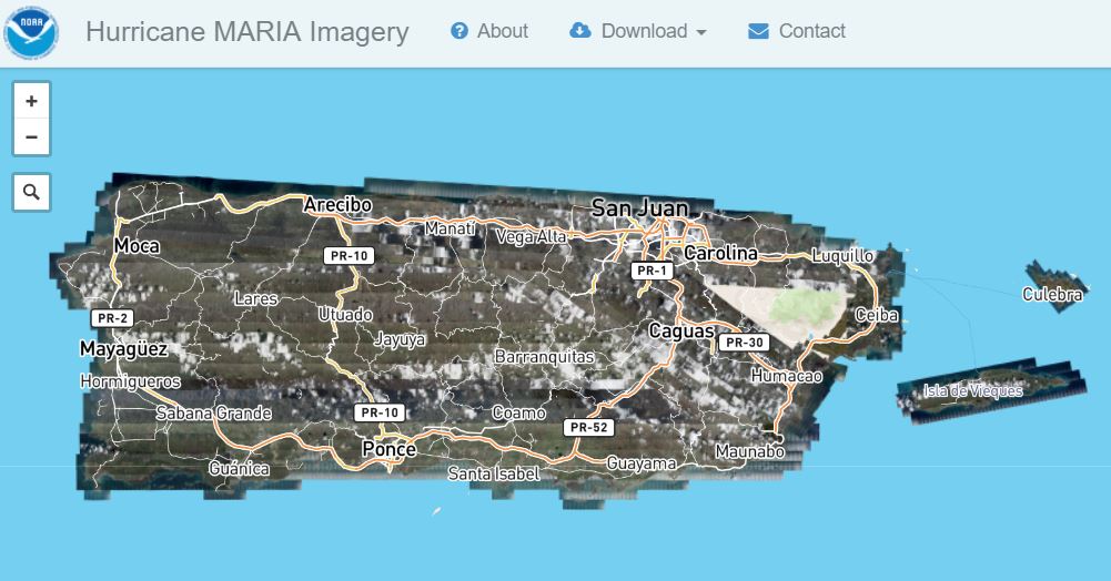 For those who are GIS proficient (and have a fast connection) some the imagery can be downloaded.
0 Comments
Your comment will be posted after it is approved.
Leave a Reply. |
Antonio González-ToroI write about GIS and Geographical topics. Archives
October 2020
Categories |
 RSS Feed