|
Para los estudiantes y maestros de ciencias terrestres, esta es una herramienta muy buena provista por NASA. 
La idea de este post es promover que las personas que viven en zonas susceptibles a tsunami en Puerto Rico visiten la página del Programa de Tsunami de la Red Sísmica .
Recientemente se han sentido algunos temblores de tierra fuertes en la isla. Los epicentros de algunos de ellos se ubican en las mismas zonas donde para el 11 de octubre del 1918 se generó un terremoto y un tsunami. Solo el tsunami, fue responsable la muerte de aproximadamente 40 personas en la costa oeste de Puerto Rico. La Red Sísmica de Puerto Rico ha preparado una serie de herramientas como planes de desalojo, manuales instructivos, protocolos, y mapas que son muy útiles para educar a la población sobre este peligro. Es importante que los ciudadanos de la isla conozcan esta información.
El mapa que ve arriba es uno general que muestra únicamente las zonas que por están identificadas por la Red Sísmica de Puerto Rico como zonas de riesgo de tsunami y que por lo tanto hay que desalojar con rapidez en la medida que ocurra una alerta de tsunami.
Como usar el mapa: 1. Busque su casa o lugar de trabajo en el mapa usando el "mouse". 2. Si esta se encuentra en una zona coloreada en rojo, esto quiere decir que se encuentra en una zona de desalojo en el caso de una amenaza de tsunami. 3. Haga click sobre el área roja. Esto lo llevará al portal de la Red Sísmica en donde encontrará mucha mas información sobre que hacer antes, durante y después de un tsunami, así como mapas de desalojo dedicados para todas las comunidades costeras de la isla. 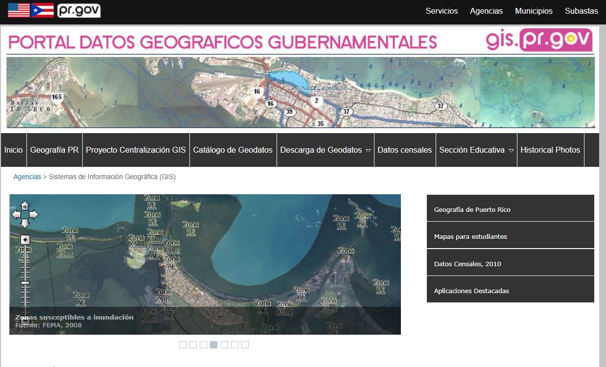 Aparte de los servicios de mapas en linea como el Catastro en linea del CRIM y el Geolocalizador de la Junta de Planificación que son muy útiles, el gobierno de Puerto Rico publica mucha información geográfica de forma gratuita desde hace muchos años. Esta página es muy util para los usuarios de programación de sistemas de información geográfica a todos los niveles. Presione la imagen para visitar la página.
 Hi all!
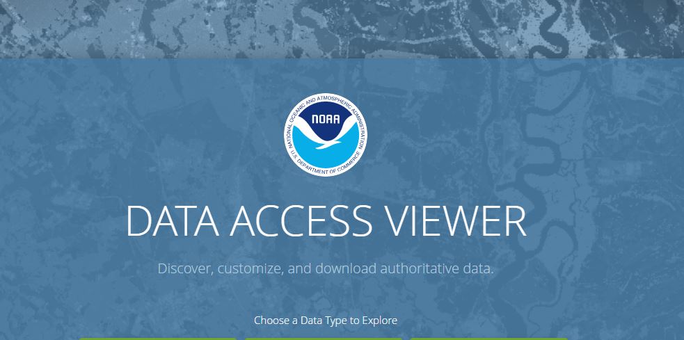
A lot of GIS data is available for free which is great for the community. NOAA has several websites that provide this service. The NOAA Data Access Viewer is one of them. It allows the user to find and download imagery (aerial and satellite) , land cover and elevation data at various scales for all the US and territories. It is easy to use and very useful. Click on the image to go to their site https://coast.noaa.gov/dataviewer/#/ Enjoy! Cartography is about information, and information is power. One of the first maps made by the American occupation army of Puerto Rico was this one by Major William Glassford under the command of General A.W. Greely in 1900. What I find interesting about this map is that it shows the location of all the possible communication routes available within Puerto Rico at the time and their relative location to military posts. This map shows how power (military) needs means of communication both as means of actual control and for its own internal workings (organization, intelligence, and planning for example) without which control would not be feasible. 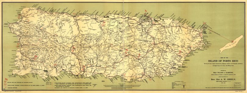 Map of the island of Porto Rico showing the lines of signal communication, telegraph, telephone, and heliograph, operated by the Signals Corps, U.S. Army, with military posts. Source: Library of Congress (retieved June 2017) - http://hdl.loc.gov/loc.gmd/g4971p.ct000304 The Glassford map was traced over an older map (a blue print) supplied by Birgadier General Roy Stone at a scale of 1:150,000. If you would like to view this map over Google Earth visit our Free Stuff page to download it in KMZ format. Here is a very rough interpretation of the communication lines and points in the Glassford map. But the map above, has much more information that would be useful for military purposes like roads, highways and rivers. 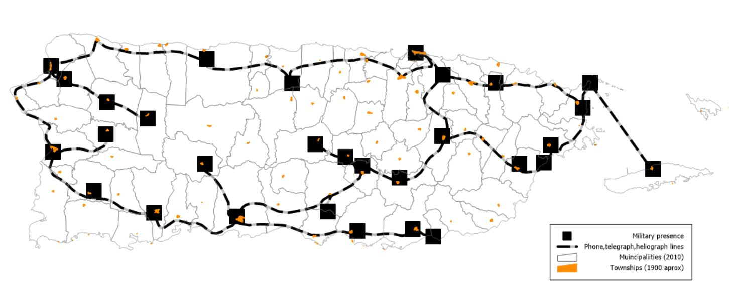 |
Antonio González-ToroI write about GIS and Geographical topics. Archives
October 2020
Categories |
 RSS Feed