|
In 1956, the San Juan Metropolitan Area was in the midst of a substantial growth period. These were the golden years of the Puerto Rican miracle and the eyes of the world were upon us. San Juan became, along with the rest of the island, a laboratory. One of the many experiments performed in the island (if one can call a plan an experiment) was the Regional Plan for the San Juan Metropolitan Area devised by Dr. Eduardo Barañano. 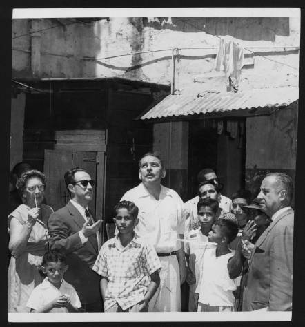 Source: UPR Coleccion Puertorriqueña. Shows (left to right) Helen Tooker, Dr. Eduardo Barañano, Luis Muñoz Marín, and Santiago Iglesias visiting a neighborhood in San Juan. Like all land use plans, the "Barañano Plan" had a particular world view that reflected what was then perceived as modernity, it included large patches of land dedicated to high density residential areas, it proposed the removal whole communities to make space for transportation systems (for cars not old fashioned rail systems!) to improve interconnectivity between townships, but it also provided for the protection and use of green spaces within the metropolitan area. 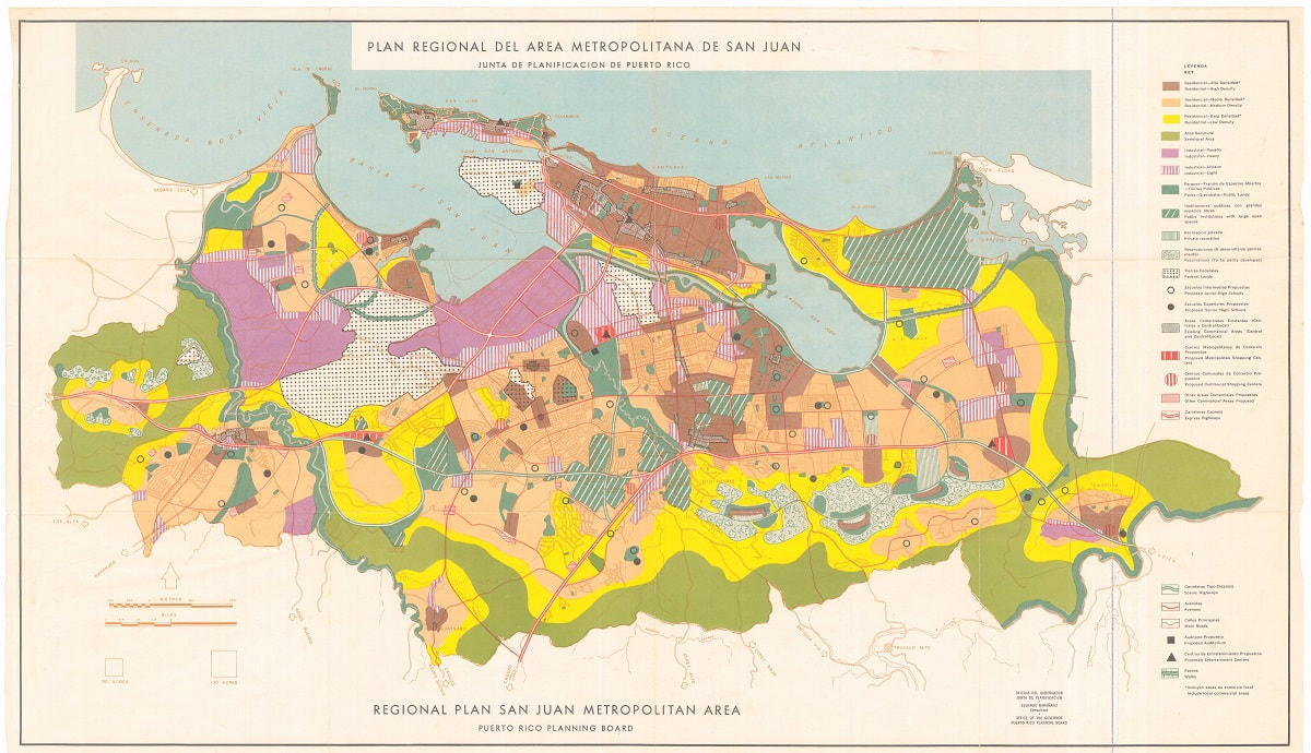 And like with all land use plans, not all was implemented. It was a good exercise. Download the KMZ file from the free stuff page and see how much (or little) of the plan became reality.
0 Comments
Your comment will be posted after it is approved.
Leave a Reply. |
Antonio González-ToroI write about GIS and Geographical topics. Archives
October 2020
Categories |
 RSS Feed